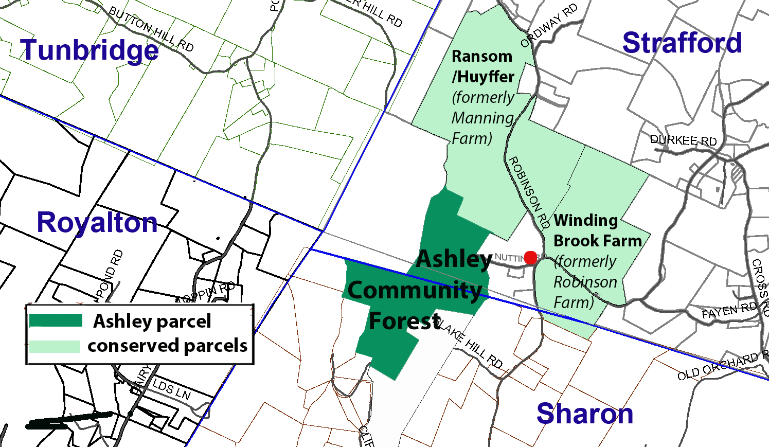
The Ashley parcel is part of the historic Robinson District near the four corners of Royalton, Sharon, Strafford and Tunbridge. Farms, a school and a cemetery still stand today in the District today. But at least one bit of its history is gone. Anyone traveling a little more than a century ago along Brook Road in Strafford (Faye Brook Road in Sharon), could not have missed the Robinson Meetinghouse, it’s location is shown on the map below by the red dot.
It was built in around 1840 by the Union Society of Strafford and Sharon, a coalition of members of Christian, Baptist and Methodist churches. Its Constitution, patterned on that of the Stafford Town House, established that it would be shared equally by all denominations.
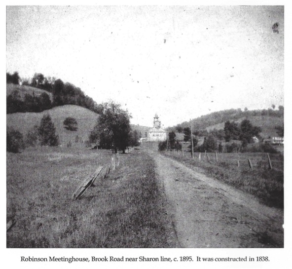
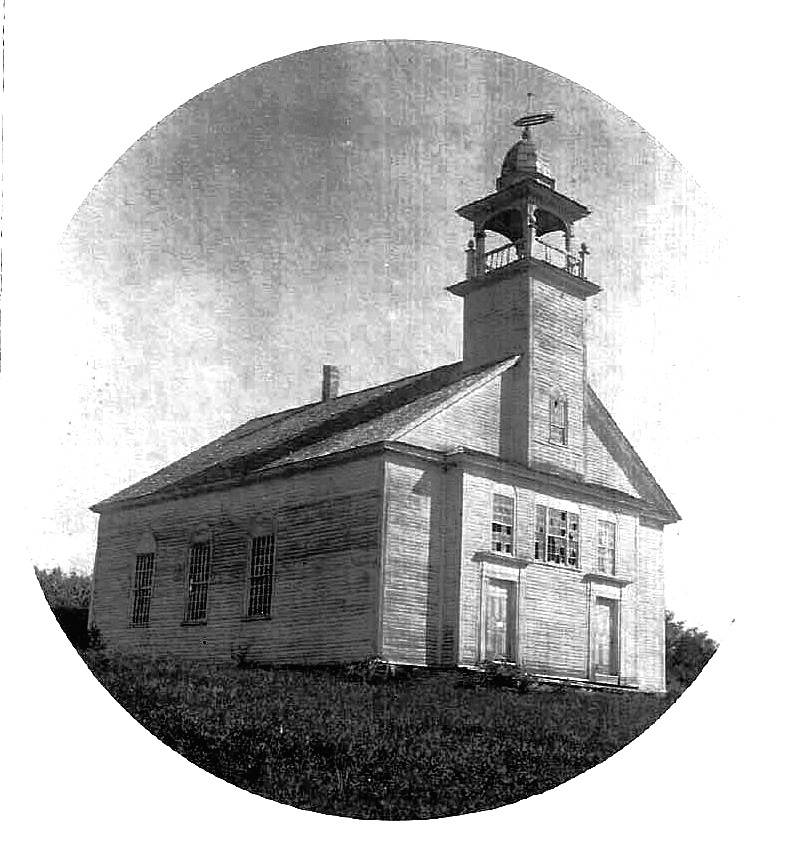
After the exodus of so many local residents westward from Vermont, the Robinson Meetinghouse was abandoned and finally dismantled in 1917. It had stood for almost eighty years on the south side of Brook Road between the Robinson Road and the Nutting Road intersections. No trace of it remains above ground. The red dot on the map above marks the spot of the Robinson District Meetinghouse.
(Thanks to Steve Willbanks for providing the description above)
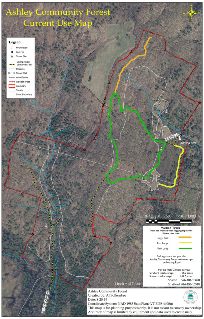
Note: Trails are in an unimproved state so use caution when hiking.
***IMPORTANT***
PARKING:
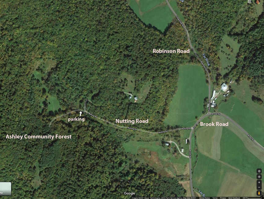
A recently completed parking area at the end of Nutting Road offers visitors an opportunity to drive right to the Forest. Please note that there is presently no sign marking Nutting Road. It is just south of the Brook Road/Robinson Rd intersection. See map below.